- Robotik - Automatisierung - Informationstechnik >
- Industriesoftware >
- LiDAR-Verarbeitung-Software
LiDAR-Verarbeitung-Software

Erreichen Sie das ganze Jahr über neue Kunden an einem einzigen Ort
Aussteller werden{{product.productLabel}} {{product.model}}
{{#if product.featureValues}}{{product.productPrice.formattedPrice}} {{#if product.productPrice.priceType === "PRICE_RANGE" }} - {{product.productPrice.formattedPriceMax}} {{/if}}
{{#each product.specData:i}}
{{name}}: {{value}}
{{#i!=(product.specData.length-1)}}
{{/end}}
{{/each}}
{{{product.idpText}}}
{{product.productLabel}} {{product.model}}
{{#if product.featureValues}}{{product.productPrice.formattedPrice}} {{#if product.productPrice.priceType === "PRICE_RANGE" }} - {{product.productPrice.formattedPriceMax}} {{/if}}
{{#each product.specData:i}}
{{name}}: {{value}}
{{#i!=(product.specData.length-1)}}
{{/end}}
{{/each}}
{{{product.idpText}}}

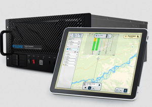
... Galaxy Onboard wurde für Airborne Lidar-Anwendungen entwickelt, die Echtzeitdaten erfordern, und für Unternehmen, die ihre Rendite durch die Möglichkeit, Projekte schneller zu produzieren und zu liefern, erhöhen möchten. ...

CoPre ist eine umfassende LiDAR-Verarbeitungssoftware, die von CHCNAV für eine effiziente und genaue mobile Geodatenverarbeitung entwickelt wurde. Sie bietet eine Reihe von Funktionen, darunter Trajektorienverarbeitung, ...

... Softwarelösung, die auf die Nachverarbeitung von massiven Punktwolkendaten ausgelegt ist. Es verarbeitet nahtlos vor Ort erfasste LiDAR-Daten in eine Vielzahl von Multi-Format-Ergebnissen. Mit Funktionen wie Punktwolkenmanagement, ...

Erreichen Sie das ganze Jahr über neue Kunden an einem einzigen Ort
Aussteller werdenIhre Verbesserungsvorschläge:
die besten Anbieter für Sie aus
Abonnieren Sie unseren Newsletter
Erhalten Sie alle zwei Wochen Neuigkeiten aus dieser Rubrik.
Bitte lesen Sie unsere Datenschutzbestimmungen, um zu erfahren, wie DirectIndustry mit Ihren personenbezogenen Daten umgeht.
- Liste der Marken
- Herstellerkonto
- Käuferkonto
- Unsere Dienstleistungen
- Newsletter abonnieren
- Über die VirtualExpo Group


Andere (bitte angeben)
Helfen Sie uns, uns zu verbessern:
Zeichen übrig